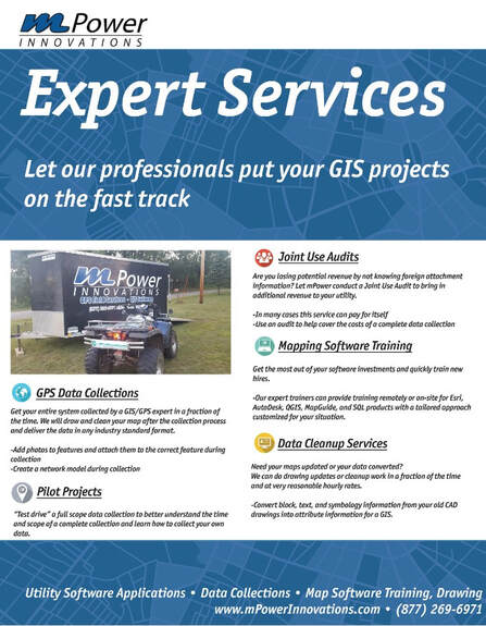
GPS Data Collection Services
|
Is your asset inventory and knowledge
recorded accurately? Proof of concept data validation, eliminates risk and delivers accurate, data-enriched “Smart Maps”. Our GPS crews have a solid understanding of multiple forms of GPS technologies, have experience using them, and continue to research new technologies on the horizon. We are committed to go above and beyond typical GPS locating services by coupling our GPS knowledge with a deep understanding of electric, water, gas, sewer, and storm infrastructures. At mPower, we provide consultation, installation, and implementation services for your GIS system, no matter the condition it is currently in. Our knowledgeable and experienced GPS/GIS technicians understand the importance of a fully functional GIS system and are committed to ensure every client’s GIS reaches its full potential. When our GPS crews are out in the field, they represent both mPower and our clients. Professionalism is very important; mPower strives to the highest standards while we are in the field conducting our work. We will utilize trucks, all-terrain vehicles (when necessary), trailers, and other equipment to expedite the collection process without losing quality of the data being collected. |
Our knowledgeable and experienced GPS/GIS technicians understand the importance of a fully functional GIS system and are committed to ensure every client’s GIS reaches its full potential.
|
Pilot Data Collection Projects
Proof of concept costs little, but delivers big.
Experienced GPS/GIS technicians build a solid foundation for your GIS system, minimizing the up-front investment to verify data is collected correctly – and integrated to your maps properly. A pilot project is vital to your continued data collection efforts by establishing a basis for the overall data collection. This process works out most of the possible road blocks that any GPS data collection is likely to run into early and further eliminates potential problems nearing the completion of the project.
Experienced GPS/GIS technicians build a solid foundation for your GIS system, minimizing the up-front investment to verify data is collected correctly – and integrated to your maps properly. A pilot project is vital to your continued data collection efforts by establishing a basis for the overall data collection. This process works out most of the possible road blocks that any GPS data collection is likely to run into early and further eliminates potential problems nearing the completion of the project.
How does this work?
When getting ready to start a Pilot Data Collection Project, a test area needs to be selected. A good pilot collection area should include a variety of the data features that will be collected throughout the project. This will help to provide a better estimate for costs and completion date of the whole project once the pilot is completed. Providing a realistic estimate of what the collection process will take in terms of both time and money is critical in managing budgets and timelines. We want to reduce or eliminate any surprises that might come as the project advances. On the first day, going out into the field to determine best practices for taking locations and gathering data with the GPS units is a must. This includes setting up what is known as a “Data Dictionary”. The rest of the week is dedicated to completing GPS data collection in the pilot area. The following week, the pilot data will be loaded into a mapping program of the customer’s choice, and then worked into the final stages of a mapping system. This allows our technicians to test the data and to confirm that the process is being performed correctly. Once the process of getting the data into its final stages is complete, a budget and timeline for the rest of the collection process and GIS deployment can be accurately demonstrated.
When getting ready to start a Pilot Data Collection Project, a test area needs to be selected. A good pilot collection area should include a variety of the data features that will be collected throughout the project. This will help to provide a better estimate for costs and completion date of the whole project once the pilot is completed. Providing a realistic estimate of what the collection process will take in terms of both time and money is critical in managing budgets and timelines. We want to reduce or eliminate any surprises that might come as the project advances. On the first day, going out into the field to determine best practices for taking locations and gathering data with the GPS units is a must. This includes setting up what is known as a “Data Dictionary”. The rest of the week is dedicated to completing GPS data collection in the pilot area. The following week, the pilot data will be loaded into a mapping program of the customer’s choice, and then worked into the final stages of a mapping system. This allows our technicians to test the data and to confirm that the process is being performed correctly. Once the process of getting the data into its final stages is complete, a budget and timeline for the rest of the collection process and GIS deployment can be accurately demonstrated.
What is a Data Dictionary?
A data dictionary is the basis for your whole GPS collection project. It holds all of the key information that will be attributed to each of the features you will be collecting in the field. Your data dictionary can be as simple or complex as you like, but needs to be comprehensive of the scope of your project and any historical data you would like to include in your final product. This means that before you set up your data dictionary, a complete understanding/view of your project needs to be in place first (with your field workers in mind). Remember, a data dictionary needs to keep things simple for the people in the field who are collecting the data, but retain functionality to be utilized in your databases and GIS system. A complete list of all the features needing GPS collection and their associated attributes is key to starting a data dictionary. The data dictionary needs to be able to capture everything in the field, and still export easily into a database. This takes time and is the most essential part of getting a GPS collection project started on the right track.
A data dictionary is the basis for your whole GPS collection project. It holds all of the key information that will be attributed to each of the features you will be collecting in the field. Your data dictionary can be as simple or complex as you like, but needs to be comprehensive of the scope of your project and any historical data you would like to include in your final product. This means that before you set up your data dictionary, a complete understanding/view of your project needs to be in place first (with your field workers in mind). Remember, a data dictionary needs to keep things simple for the people in the field who are collecting the data, but retain functionality to be utilized in your databases and GIS system. A complete list of all the features needing GPS collection and their associated attributes is key to starting a data dictionary. The data dictionary needs to be able to capture everything in the field, and still export easily into a database. This takes time and is the most essential part of getting a GPS collection project started on the right track.
|
|