|
Iron Mountain, MI and Wakefield, MI December 26, 2019 -- Last month the City of Wakefield unanimously approved a proposal from mPower Innovations to provide a powerful enterprise GIS solution to help digitize their electric and water system assets and maintenance processes. This system will help the City of Wakefield support its goal of constantly working to improve and provide reliable service to their residents.
The City of Wakefield will utilize mPower’s Integrator software, a powerful web-based GIS asset management and system integration application that will enable the City of Wakefield to view and update all of their utility assets and access critical information from one browser-based system—eliminating the tedious process of searching for information in multiple sources and maps. Moving to a GIS-based asset management system will dramatically improve communication and response time to planned and unplanned service interruptions and maintenance. “With mPower, the City of Wakefield will leap into the 21st Century by deploying powerful technology that will provide City Staff with quick access to information, dynamic reports, and the ability to track an accurate inventory of City assets. In addition, residents will be able to view and report power outages and submit work orders from the comforts of their mobile devices. The City of Wakefield is excited to deploy this software in the coming months,” said Robert Brown Jr, City Manager of Wakefield. Jason Brown, President and CEO of mPower Innovations added, “Partnering with mPower is a positive signal that the City of Wakefield is embracing new technology and committed to the residents and customers they serve. Building a solid GIS is critical to the maintaining an efficient, safe, and reliable utility.” The City of Wakefield is one of mPower’s many Michigan municipal customers. The city has completed the onboarding process and is expected to have a fully functional GIS solution by the end of the year.
0 Comments
mPower Innovations will be exhibiting at this years E&O Conference in Raleigh, NC on April 30th and May 1st. Visit us at booth 401 or register for our post show reception at Jimmy V's from 7pm - 11pm here.
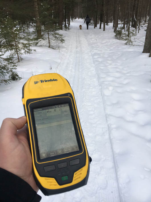
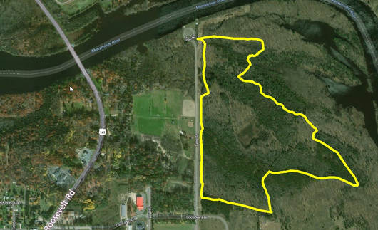
Learn about new product features and meet our current customers who are using our software and services. Register for the conference here. Niagara, WI- mPower Innovations, a national GIS (Geographic Information System) software and services company based out of Iron Mountain, Michigan is lending their technology to help the Niagara Area Business Association (NABA) map out their ski and snowshoe trails for their fourth annual Candlelight Snowshoe and Ski Event in February. Using a GPS coordinating device produced by Trimble, mPower Innovations mapped out this year’s trails with pin-point accuracy. The devices they used for this project are the same devices they use to map out assets like power poles, fire hydrants, and metering devices for their clients. The GPS devices connect to two constellations of satellites, one owned by the United States and the other by Russia. “This is a great community event and we are proud to be a sponsor and help with their maps,” said Daniel Freeman, Marketing Manager for mPower Innovations, “We typically map out assets on a much larger scale but this is a simple service we can provide and we are happy to help.” The Niagara Area Business Association is hosting its 4th Annual Candleight Ski and Snowshoe event on Saturday, February 3rd. You can register at event or visit www.niagarawi.com for more information. For more information about mPower Innovations you can visit www.mpowerinnovations.com or call (877) 269-6971. The Trimble unit used to map the trails. One of the routes mapped out for the Candlelight Snowshoe and Ski Event.
|
About usmPower is a full-service, one-stop-shop for utilities and organizations at any stage of GIS and Smart Grid integration. Learn more about our company here. Categories
All
|


 RSS Feed
